Gorgeous Kyrgyzstan, 2012-June-5 >>> June 15.
2012-06-05> 125km / 621hm / no wind / slightly cloudy / only 23°C / Ø 17,4.km/h / pedaling time 6:58hrs / day 42
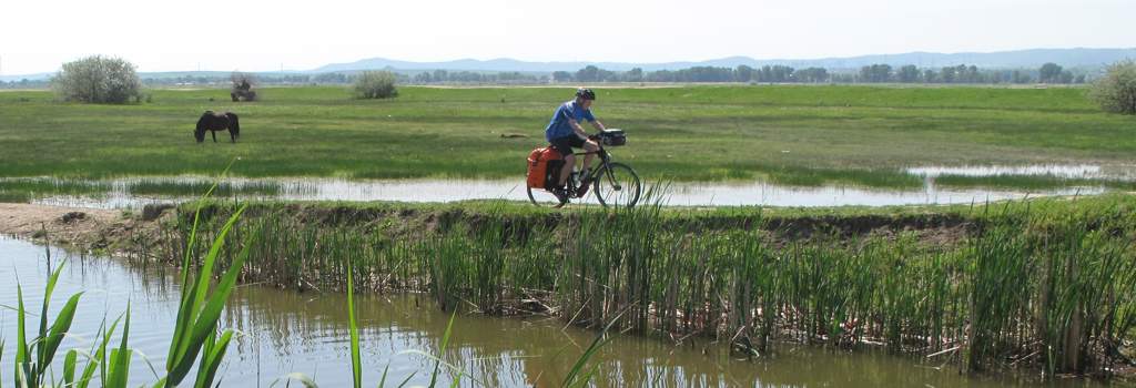
Departure Taraz with navi problem, a man send me to the wrong border, so 15km detour on very bad road. At the real border post I meet the TR / TJ truck drivers again from KZ, 10 days ago, on the way to Afghanistan, I could not understand what they had been doing the whole time, later on I meet them again in Talas, they are not much faster than me. Customs and immigration in KZ very slow and bureaucratic, in KG very efficient and fast. After crossing the border, a long uphill stretch to the Kirovskaya reservoir, with its large concrete barrage with a huge stone head of Lenin. Change of landscape, towards more rocky mountains and then again wide open spaces. The homes in the villages are neater than in KZ, people seem have a sense for decoration (mountain people) Stopped in Talas, the town where in April 2010 the revolution started, which overthrew president Bakiev and his government. About 90 people got killed at that time. The local gastinitza is located on the main road with a typical grocery magazine next door. No running water, the usual toilet arrangement is behind the house and a pump for water is in the garden. A bit of noise from the couple in the room next door, but they left at about 2:00am
KG -Talas Gastinitza @ N42°31.843’ E072°12,988‘ Elevation 1218m
2012-06-06> 112km / 1980hm/ max elevation 3268m / rain and fog at the peak / morning sunny / 4 - 33°C / Ø 13km/h / pedaling time 8:40hrs / day 43
Good start in the morning and continuously going uphill, many small towns on the way, in last town Taldy Bulak, before the Ötmok pass are few shopping places, many water pipes along the streets. Weather gets worse with fog, rain and light hail on the way to the peak. (3300m) There is still a lot of snow on the side of the road. Going down, the weather gets a bit better. At about 2700m I left the Talas road (A361) to continue on the Bishkek – Osh road (M41) Fortunately the sun came out again and I started looking for a place to camp, around about 5:30pm I spotted a nice, level piece of grass land with lots of flowers, however it’s a bit tricky to get there. A shepherd watched me and I asked him if I could pitch my tent in this spot. He nodded with a smile and I assumed it was OK. Later I saw that his yurt was only a few hundred meters away, from my place, down by the river. As the sun was about to disappear behind the big mountains, I ate the usual stuff, sardines, bread, some goat cheese and Snickers for desert.
The temperature was going down quickly, but with a double layer of clothing and the winter socks, I was warm enough.
In the morning I discovered that some of my stuff was covered with a thin layer of ice. With all the flowers and snowcapped mountains, this was the most beautiful camp site so far. I woke up from the warm sunrays in a crystal clear sky with the moon still above the horizon. The shepherd had already led his huge herd of goat’s way up the mountain and came down with his two kids to watch what I was doing. His little daughter had picked a tiny bunch of flowers for me and he gave me some kind of rhubarb to eat. Luckily I still had some cookies to share with them.
Camp @ N42°12,348’ E073°10.020‘(elevation 2650m)
2012-06-07> 78km / 431?hm / max elevation 3182m / sunny all day / 8 -30 °C / Ø 17,3.km/h / pedaling time 4:22hrs / day 44
Great start in the morning, beautiful weather. After only about 15km uphill cycling. I stopped at another yurt to get some breakfast, chai and freshly baked bread with some of the traditionally fermented milk. Very nice couple with a small daughter. At first they did not want to take any money, but I needed more fresh bread and some Kumys (fermented mare’s milk), so they accepted a small amount of Som’s, the Kyrgyzstani currency. Along the way I took more and more pictures, as the light turned everything into stunning color schemes, but then the pictures are not nearly as nice as in real life. After going uphill for a while, I crossed the Ala-Bel Pass at 3175m. From there it was mostly going downhill, alongside really beautiful mountains and following the Naryn river most the time. When I wanted to buy more of the dry cheese balls in one of the spectacular valley’s, I met a young French girl who was staying with a Kyrgyz family – she was planning to spend her vacation there. I arrived fairly early in Toktogul and checked into the local gastinitza for only 200Som. Later a young hitchhiker with the name “Or” from Israel arrived and asked me if I would like to join him to go for a swim in the big Toktogul reservoir which filled the whole valley. I thought he knew the way to get there quickly and since the hotel did not have any water, it was a good chance to rinse off the dust of the day. Unfortunately it was much further than what we had anticipated and when we arrived there, the sun was about to set. There was still time for a quick dip and enjoying the sunset at the other end of the lake. But it does not take long to get pitch-dark in this country, so we walked as fast as possible to get back to Toktogul. Nevertheless we got lost and wondered around in total darkness, until we saw a house with lights and asked for the way. The guy in the house was so nice and got into his shoes and walked with us for at least half a km to get to the right track. 2 more friendly souls did the same until we hit the lights of Toktogul, then a Toyota picked us up and took us all the way to the hotel. By that time it was past 11pm. Beside the fact that we got lost, it was a great evening and we talked a lot on our walking tour about traveling, life in general, and the strange situation that people on this trip still feel that they have to say heil hitler when they meet a German. Or thought that this was not amusing. But it is a result of all the WWII movies on TV which people watch for entertainment and there seems to be little information about the holocaust. Or wanted to take the early bus at 7am to Osh, I could at least sleep a bit longer. The gastinitza was not very good and too noisy, later I heard there is a much nicer place in town, apparently even with showers.
Toktogul @ N41°52.812’ E072°56.652‘ / Elvtn.about 1000m
2012-06-08> 112km / 1187hm / sunny + light rain in the afternoon / Ø 14,5.km/h / pedaling time 7:38hrs / day 45
After Toktogul I was cycling the whole time along the reservoir, and later part of the Naryn river, with nice views of the lake and the mountains, but the air is not as clear as yesterday. Many up’s and down’s. and a long steep climb to a pass at 1400m, where dozen’s of French cyclists were racing down with police escort. My guess, about 80? People. Its an organized cycling tour Beijing-Paris-London FFCT.Org. Unfortunately I could not talk to them as they really seemed to be in a hurry. In the valley strong headwind but going downhill most the time, light rain. Perfect rafting river with fascinating rock formations. The Gastinitza in Karakul, is an old fashion soviet style house with shower and toilet. Laundry day. The hotel lady gave me a big pot of chai and some fresh bread.
Karakul @ N41°37.931’ E072°39.422‘
2012-06-09> 140km / 1005hm / 34°C / Ø 14,6.km/h / pedaling time 9:25hrs / day 46
Morning late start because of bank, pharmacy, search for internet, shopping. The road has many uphill sections, but very good surface, until the evening, it follows the now beautiful turquoise river Naryn / and reservoire with a big power plant. 4 tunnels to cross. Not very good for pedaling old man, too dark, too much contrast from the sunlight. Meeting a Dutch couple with a Land cruiser, 2 Russians with BMWs and a Romanian motorcyclist, all really nice travelers. Cycling until late and arrive in Kochkorata aftter 22:00 in total darkness, the whole area has no power that day, the last 20 km of the road is totally dusty and in terrible condition, 2 slightly drunk guys help me to find the gastinitza, cold water shower, otherwise nice and clean (expensive)
Kochkorata @ N41°02.141’ E072°28.953‘
2012-06-10> 154km / 1037hm / sunny all day/ 33°C / Ø 15,2km/h / pedaling time 9:52hrs / day 47
Long driving day, lost all tracks on the Garmin and had to reload at a truck stop. Almost along the whole road farms, large sunflower fields, cabbage, cucumbers, water melons, not good for camping, too many people, heavy traffic following the Uzbek border line. 30km before Jalalabad a young guy on a MTB talked to me and we cycled together all the way to Jalalabad. At half way he stopped to buy me a coke, nice fellow, I wanted to pay for his ice tea but he refused. Later lunch stop, good food with fish and eggs, the owner of the café used to be in the soviet army in Neurupin in Germany, spoke a few words of German. My garmin keeps giving me trouble, looses tracks, and the hm reading is definitely not right, at least 30% below the real value. Cycling mostly though the Fergana valley then rolling into Osh at about 22:00. This is the second biggest city of Kyrgyzstan after Bishkek the capital. It has a 3000 year history. The roads in town are a disaster while out in the county 90% of the roads are fantastic, similar to Russia. Hotel Osh is again an old soviet style establishment with administrator ladies on each floor. Run down, but everything works, water, shower in hallway, el. power. no internet. No wifi
Hotel Osh @ N40°32.124’ E072°47,538‘
2012-06-11> 0km / sunny all day/ 33°C / day 48 resting day in Osh
Meeting 2 French couples with Land Cruisers, touring Uzbekistan and Tajikistan, laundry day. Walking a bit around Osh, big bazar near hotel, flair of an old silk road market place. More ladies with scarfs or burka. Searching for internet place with wifi, no luck. Traffic is chaotic.
2012-06-12> 85km / 1460hm / mostly sunny in the morning, afternoon thunderstorm/ about 8 - 33°C / Ø 13,2km/h / pedaling time 6:02hrs / day 49
Leaving chaotic traffic in Osh, many old Japanese cars with RH steering. Road M41 is really in a good condition, new pavement and marking. Leading into the mountains less and less traffic. Many places to get food and water. Beautiful snow-covered mountain ranges, with lots of yurts and many horses, reaching town just minutes before a big thunderstorm. The Gastinitza is totally run down, nothing works. No water, all sinks are broken, pipelines disconnected, windows mostly broken, power only in the hallway where the TV set is. The manager is a nice fellow, but doesn’t really care a lot about the condition of his “hotel”. He told me that a French cyclist was here a few days ago.
Gulcha @ N40°18,865’ E073°26.222‘
2012-06-13> 105km / 1928hm / partly sunny, later rain and thunder storm / Ø 11,5.km/h / pedaling time 9:03hrs / day 50 / total 4363km
Hotel manager wanted picture riding my bicycle, then we go to his friends restaurant for breakfast, he orders some kind of Dimsum and chicken shashlik with bread. Weather does not look too good today. Somewhere along the road I meet a motorcycle fellow from the UK, he warned me that further up the road will be construction site, with a very rough detour. After leaving Gulcha it is mostly going uphill and at about 2pm I am hungry again, time to stop at another road-side cafe for lunch. 2 girls are running this nice little place, with a huge picture of Mecca on the wall. After the meal I’m full of energy and start to conquer this long, impressively winding path to the Taldyk pass. As I get higher and higher the temperature keeps getting lower and lower. Above 3500m it is only about 2°C, so every once in a while I have to walk my bike, to get my feet warmed-up again. Unfortunately the motor-cyclists predictions also becomes reality and beside the steep climb I have to battle with huge potholes and really rough gravel. After I reached the first peak at 3615m it gets better and at least half of the road is asphalt again. Then I can fly about 350m downhill, only to climb another ascending section to almost 3550m. By the time I roll into Sary-Tash it is already dark again. At a small truck-stop I get a nice big plate of “lachman” noodles with bread, at a table with 3 Kyrgyz / Uzbek truckers who had just arrived from China. They are very nice guys. and later on I share the dorm with one of them from Uzbekistan.
Sary-Tash @ N39°44.439’ E073°14.116‘ – elevation 3175m
2012-06-14> 77km / 928hm / highest elevation point 3771m / partly cloudy, windy with rain and soft hail / 6 to 19°C / Ø 12,5km/h / pedaling time 6:07hrs / day 51
Sary-Tash really is a tiny little place with only one gas station. I expected it to be much bigger. I left the truck-stop which is on the west side of the village after breakfast, picked up some fresh water and chocolate in one of the local shops and was hoping to get internet somewhere, but that was a total illusion. There was not even a chance to get a mobile phone signal. This place does not have much to offer, so I started heading further to the east to get to the Chinese border as quickly as possible. I had to cross another pass today, the highest on the whole trip at 3771m. The whole way I had a nice view of the Tian Shan mountain range with some peaks well above 7000m. I was a bit sad that I had to leave Kirgizstan and the snowcapped mountains, but on the way I had a lot of chances to take more pictures. Around noon time it became extremely windy with some soft hail and rain, so I decided to have a lunch break at a small house, where they were just baking fresh bread. I left after the rain had stopped. Nice family. Late in the afternoon arrived in Irkeshtam, which must be the crummiest town in of all Kyrgyzstan. The whole place almost looks like a squatter camp, with very few real buildings but lots of old rundown trailers. No toilets, most people just do what they have to out in the open field. All the trucks heading or coming from China stop here. The border post itself is a nice new building. I asked for a gastinitza and the lady told me that she had one. Well, it was one the old trailers, surprisingly it was really nice inside and I had to share the place with mama – papa and the 6 kids, 2 of the boys must have been already in their late teens and went with their father to work in the morning. When I showed the family some pictures of my last 2 days, they got very sentimental end excited that I had some photos of the their home farm. I guess they would rather be there instead of Irkeshtam. But here they can get some kind of work. The oldest daughter must have been about 15, and she was telling me that she was going to school in Osh, but now has the summer break. The local magazine was also in one of those old trailers and so was the bank. About 2 km before Irkeshtam is a really neat little town called Nura, with all nicely painted houses, in full contrast to the border place.
Irkeshtam (border town of Kyrgistan) @ N39°40.665’ E073°53.905‘